Why hike the Faulhornweg?
Lonely Planet named the hike from Schynige Platte to First via the Faulhorn the best day hike in Switzerland, calling it the "holy grail of day hikes".
They're not the only ones to use the term. The Earth Trekkers website went even further - they added it to their list of the best day hikes on the planet. High praise indeed.
After flirting with the idea on previous trips, I finally took the plunge in September 2022 as part of my interrail jaunt around Switzerland.
The low down
Route: Schynige Platte to First via the Oberberghorn and Faulhorn (click for Strava)
Date: Tuesday 20th September 2022
Distance: 11.68 miles
Elevation gain: 3,760ft (1,146m)
Highest point: Faulhorn summit at 2,681m (8,796ft)
Time taken: 7:44:22, of which 5:16:34 was actually moving
Getting there: ascend via the Schynige Platte Bahn from Wilderswil and descend using the Grindelwald-First gondola cable car. The Berner Oberland Bahn will return you to Wilderswil (and Interlaken) along the valley.
Buying a ticket: there’s a special hiking ticket that gives you one ascent to Schynige Platte and one descent to First (or vice-versa) plus travel back to your starting point. If you are staying in the region for a few days, I would strongly recommend the Bernese Oberland Regional Pass or the Jungfrau Travel Pass.
The hike
The little mountain railway to Schynige Platte wasn't new to me when I boarded the first uphill train of the day at Wilderswil in September 2022. I'd last visited during a lockdown-dodging break in August 2020, which is fortunate news for this article and for you, dear reader, as I failed to take any photographs of the Schynige Platte Bahn on my most recent visit. In 2020 I had started the day in Basel and only had time for the comparatively short hop to the nearby Oberberghorn; in 2022 I'd booked in for two nights at the nearby Hotel Bären (Bear Inn) to give myself time for the full monty - all the way to First via the Faulhorn and Bachalpsee.
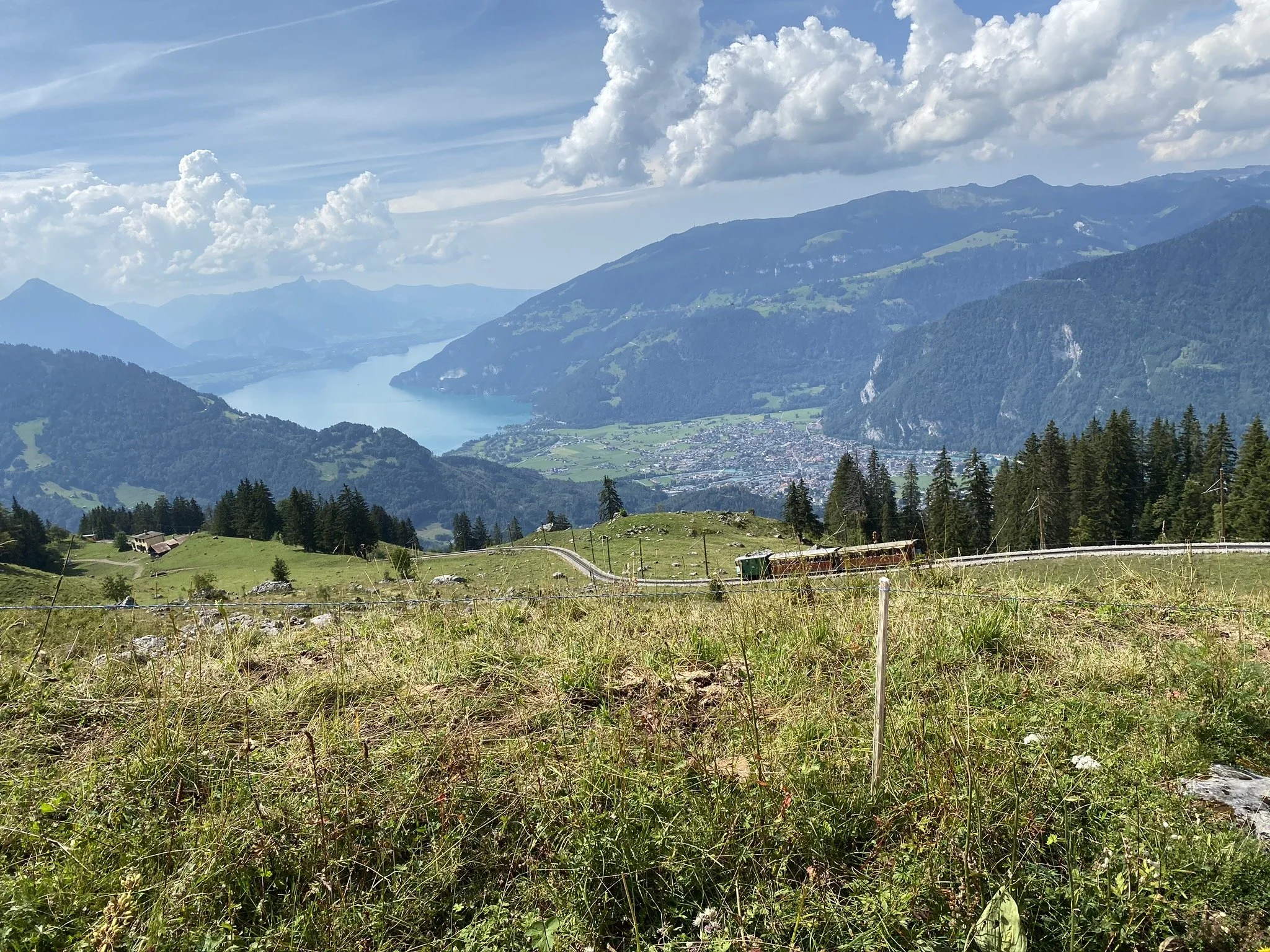
Schynige Platte Bahn train descending towards Wilderswil with Interlaken and Thunersee in the background. Photograph taken in August 2020.
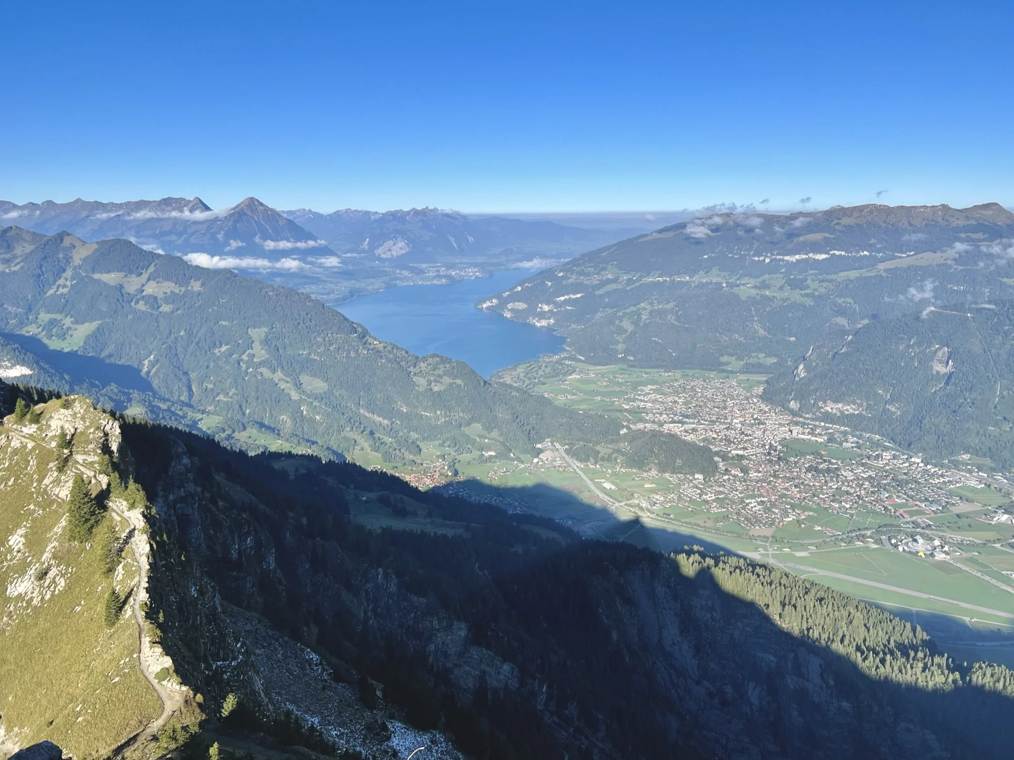
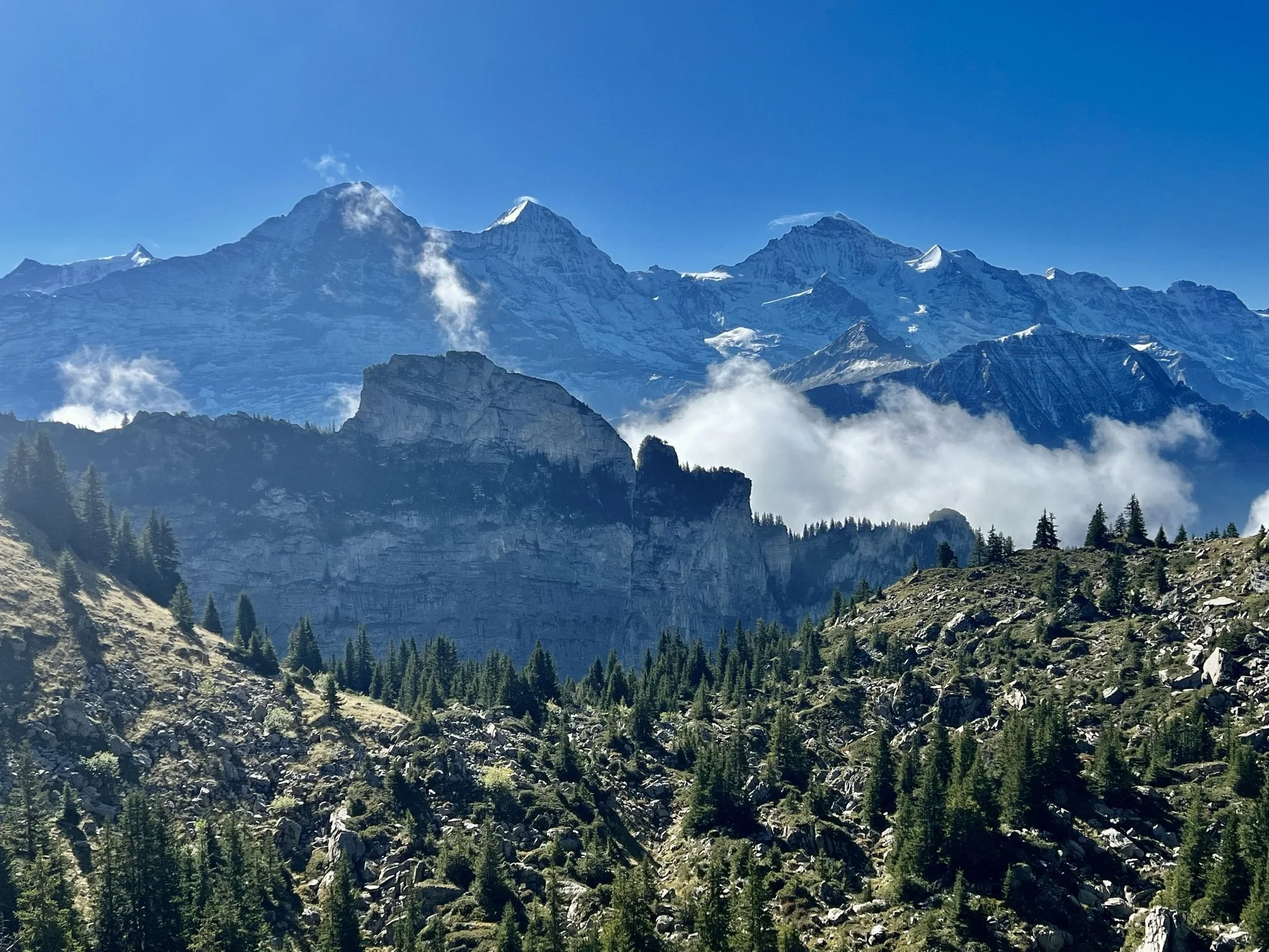
I could have stayed at Schynige Platte for the whole morning. I think it might be the best spot to view the Eiger, Mönch, and Jungfrau in their full glory, and on this day there's a spectacular addition to the scene - a beautiful cloud inversion over the Lütschental providing a contrast to the high peaks. I took some snaps and resolved to keep moving - although I'd given myself plenty of time, this hike does have a hard cut-off time - it's a long, long extra walk down to Grindelwald if you reach First and the gondola has stopped for the evening.
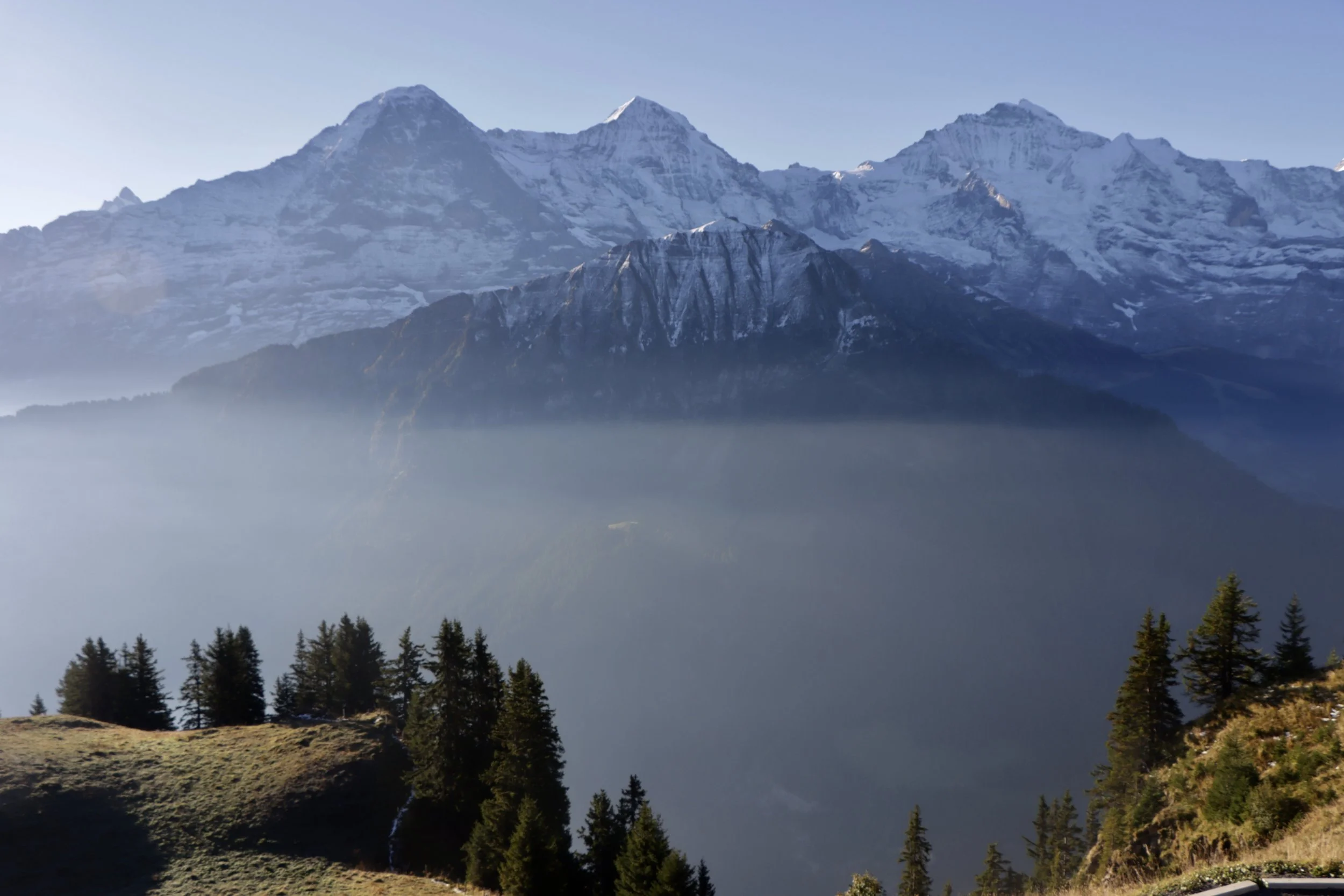
Eiger, Mönch, and Jungfrau from Schynige Platte, and the mists of the cloud inversion.
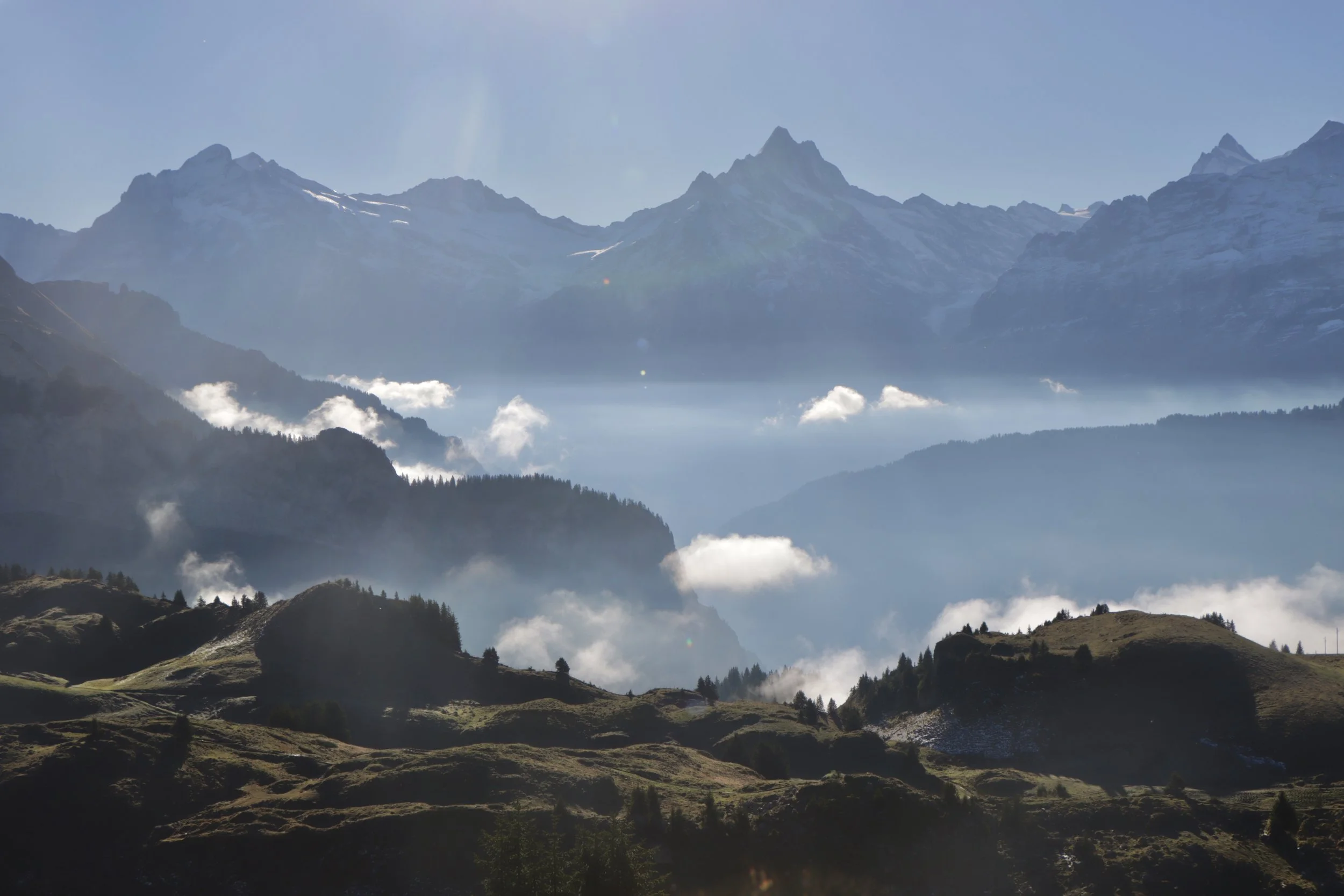
Another view of the inversion, this time with the Schreckhorn in the distance. This was taken a little further along the walk.
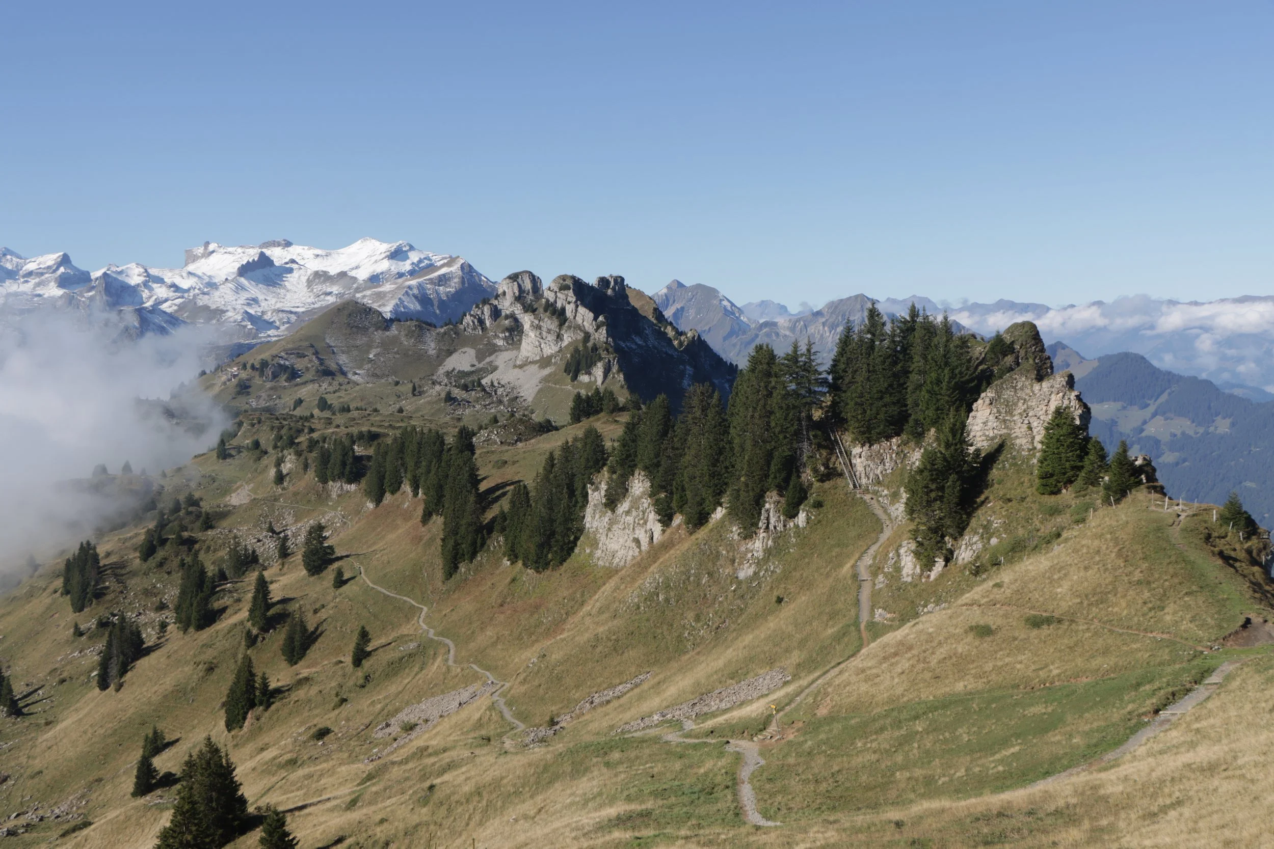
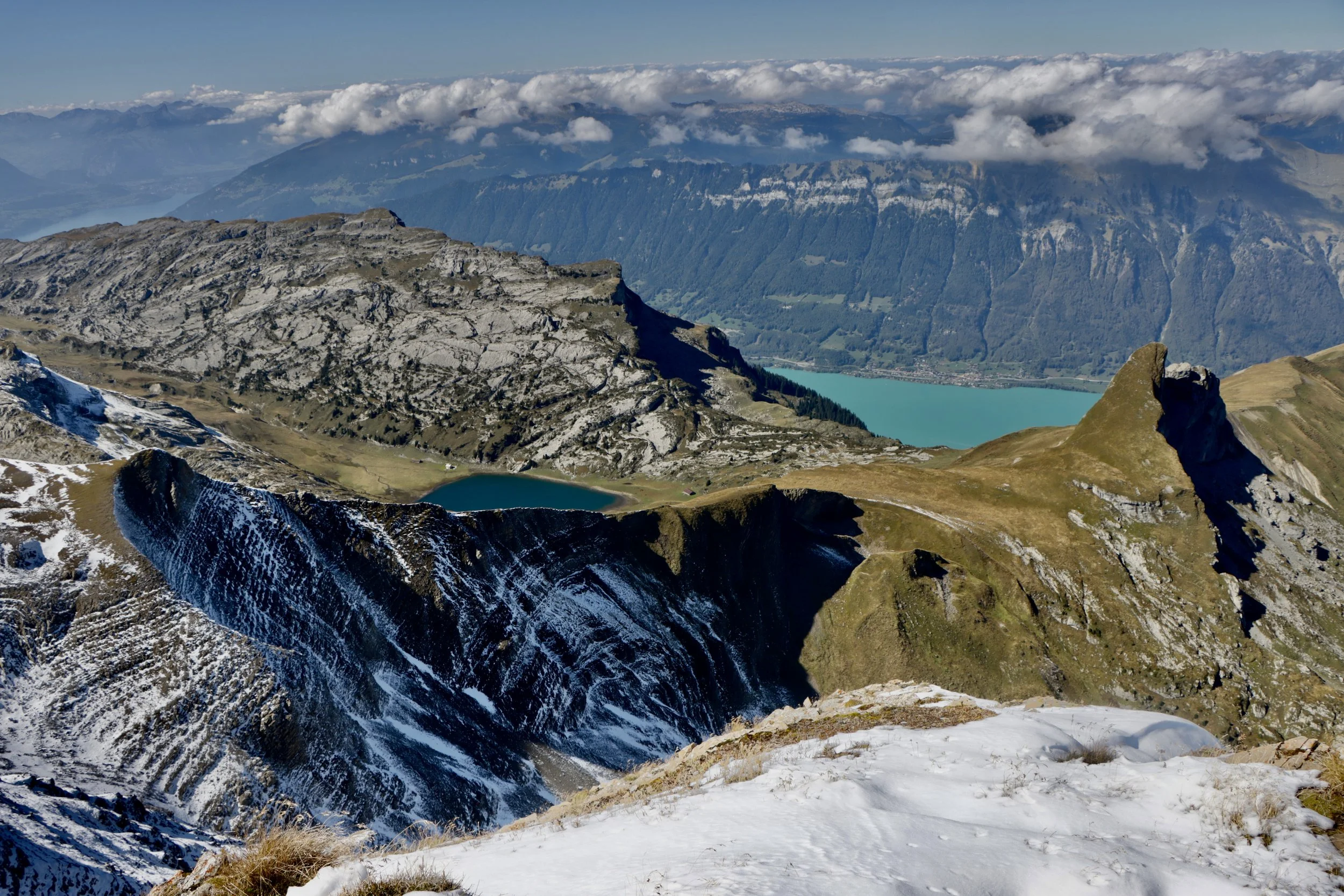
Nevertheless, by starting so early, I'd allowed myself the indulgence of taking the longer route at the start of the hike. The shortest route dives downwards from the not-quite-summit station at Schynige Platte and crosses the alpine meadows that lie between the station and the Loucherhorn. A more panoramic route takes you briefly north around the inaccessible Gumihorn (2,099m) to a subsidiary viewpoint called Daube (also sometimes known as Tuba - 2,076m). It then follows the ridge to the short, sharp climb to the summit of the Oberberghorn (2,069m).
This route affords extraordinary northwards views down to Brienzersee and Interlaken, and across to the Hardergrat ridge, without the need for any compromise of the view to the south. It also gives an early reminder that this is a proper alpine route - it's a solid and reliable path but it dances with the sheer edge all the way along the ridge.
The final ascent to the Oberberghorn also involves what are invariably described as steps but would more charitably be called a pair of ladders - a head for heights is definitely required. The rocky summit platform has a safety fence.
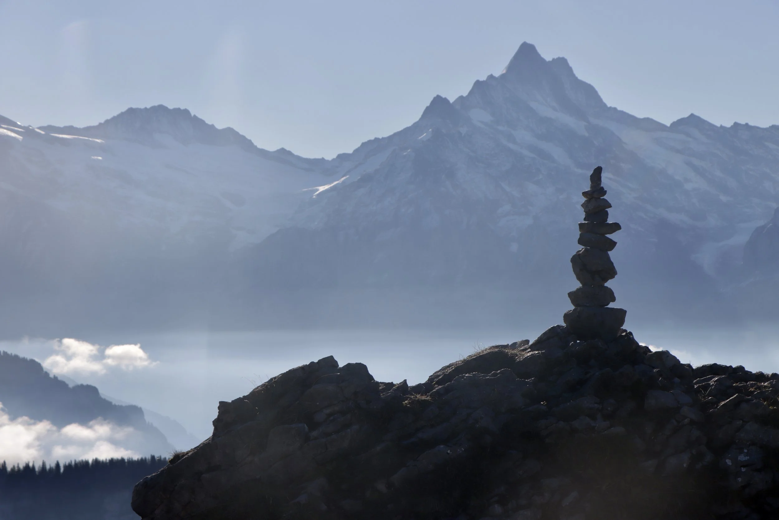
Cairn on the Daube summit with the Schreckhorn beyond
Looking back towards Daube from the Oberberghorn summit
Looking down on Interlaken and Thunersee from the Oberberghorn summit - the Daube ridge line is on the left of the photograph
Looking east from the Oberberghorn summit towards the Loucherhorn. The ridge line of the Hardergrat is visible across Brienzersee.
A close-up of the Gumihorn. This is the highest point at the Schynige Platte end of the ridge but the summit is not accessible without a rock climb.
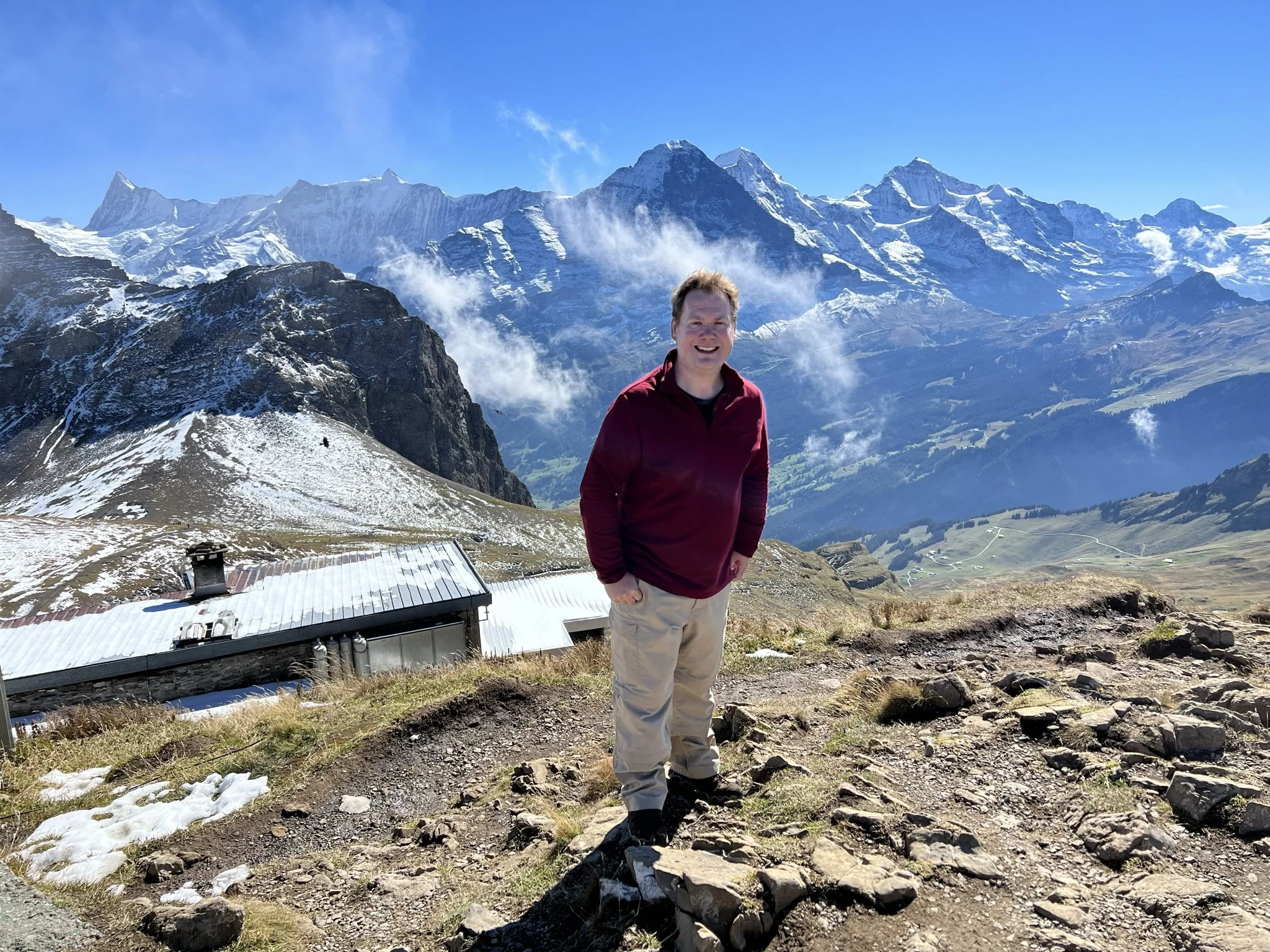
Not the best picture of me ever taken
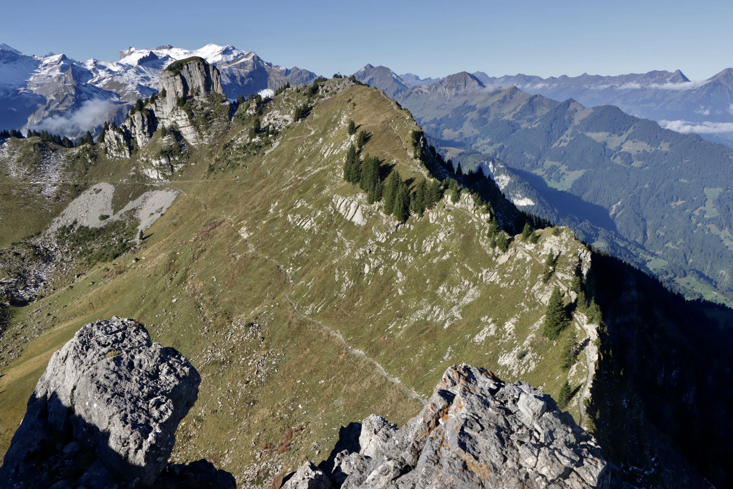
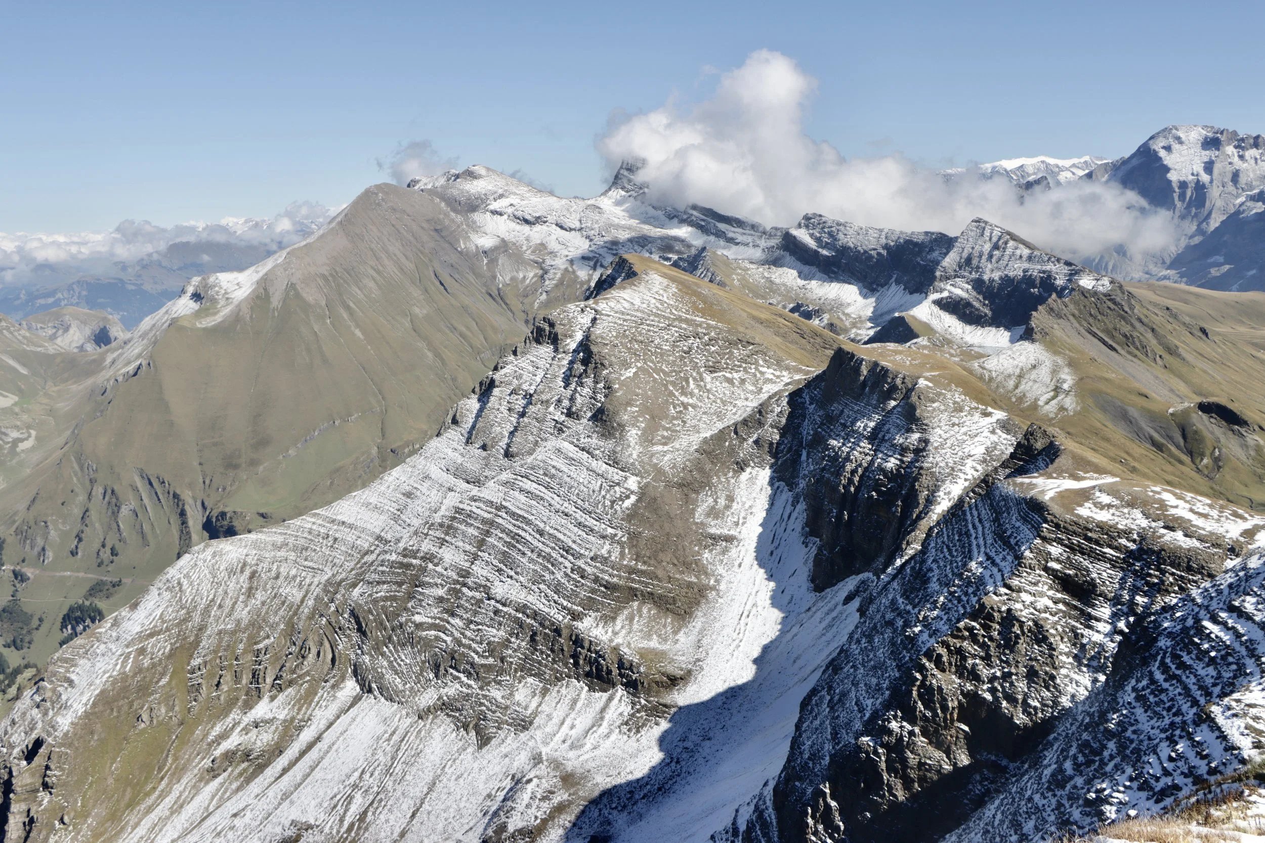
Once you've traversed the Oberberghorn ladders for a second time, you realise the trade-off you've made by opting for a more spectacular opening - every metre you've climbed, you now have to give back - and then a bit more. The path heads towards the Loucherhorn and you descend to meet the direct route over the meadows before skirting the Loucherhorn to the west and then the south. The view to Brienzersee and Interlaken mostly vanishes, but for now you've still got the rewards of the view to the south as well as back over the terrain already covered.
Looking west from the slopes of the Loucherhorn. The Oberberghorn summit is in the centre of the shot. The direct path from Schynige Platte, avoiding the Oberberghorn, is clearly visible rising up the mountainside.
Another view from the slopes of the Loucherhorn
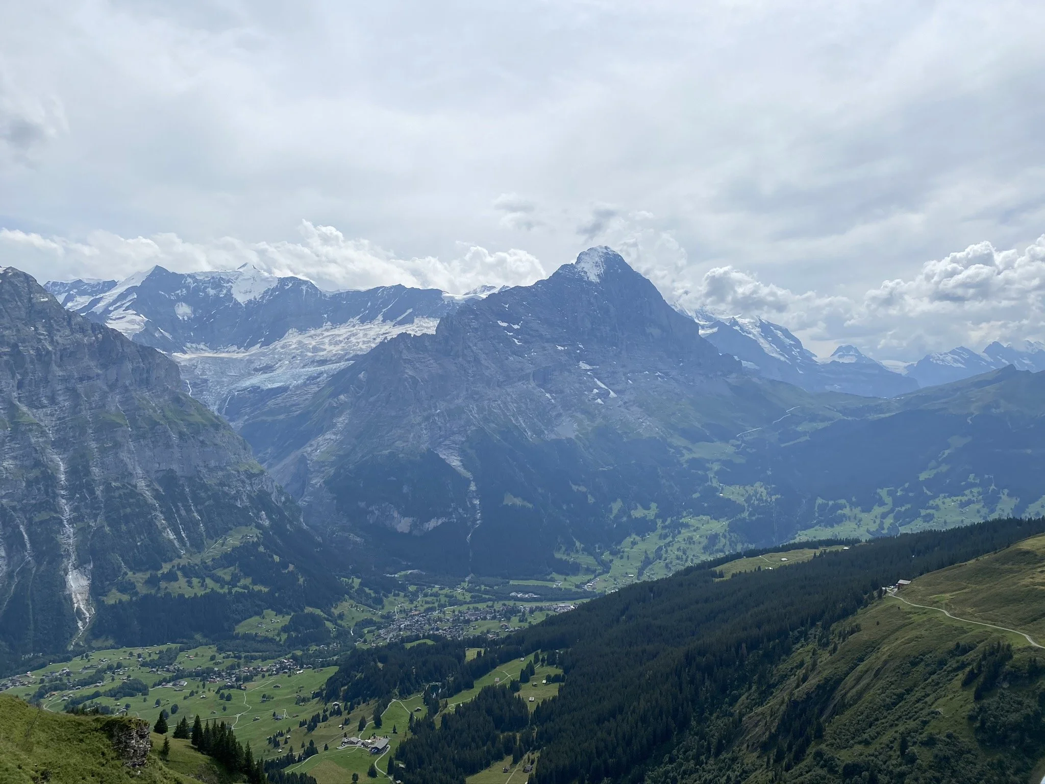
Another look at the Eiger, Mönch, and Jungfrau. In the shadow of the Jungfrau, you can just make out the Lauberhorn, famous for the annual Skiing World Cup race.
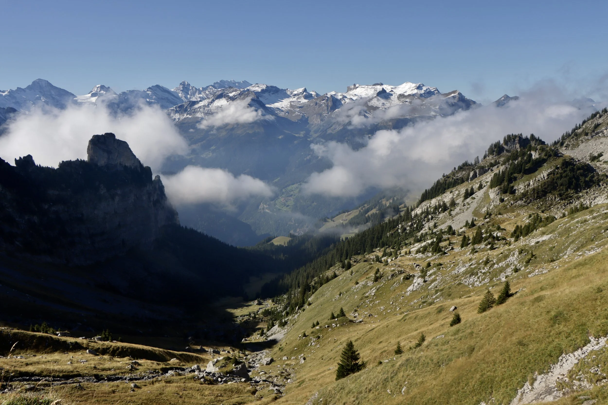
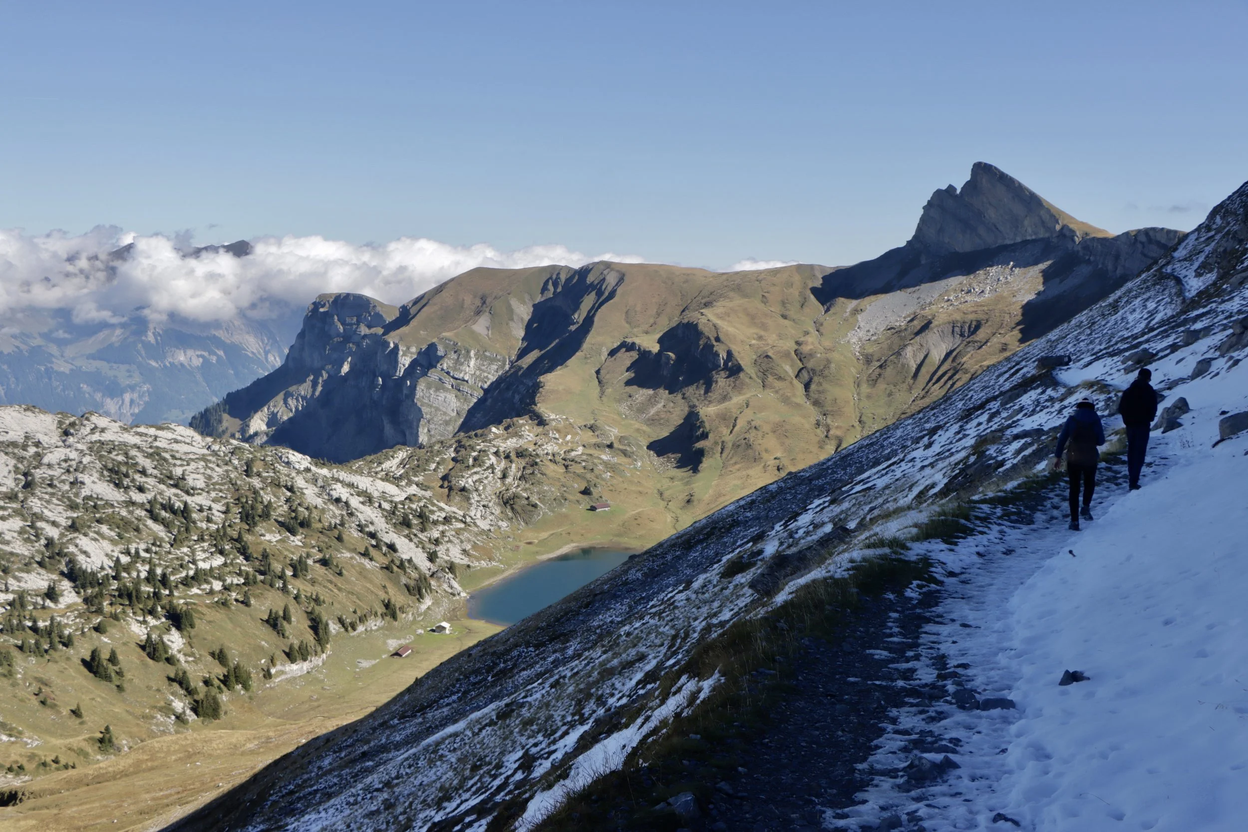
East of the Loucherhorn, the route crosses a minor watershed and enters the Sägistal. Far below is the pristine and isolated Sägistalsee, and the trail continues under the northern shadow of the Sägissa ridge. I quickly found out how important this was, as I almost immediately ran into the snow.
Looking up at the Sägissa ridge
The snow was a novelty at first but it quickly became apparent that this wasn't just an isolated patch and it was going to create a significant additional challenge. It was a real lesson in checking mountain weather - as I was hiking solo high in the Alps (albeit on a very popular trail) I had chosen my day carefully, and only set out on a clear, sunny day under benign conditions. I had however not appreciated the lingering impact of the previous day's snowfall, especially as it was very early in the season for snow to build up at such a (relatively) low altitude.
The route climbs gradually above the valley before doubling back for the clamber up to the mountain hut at Männdlenen. Although the trail is wide here, the drop down into the Sägistal was significant enough to slow my pace down to a (not literal) crawl while I traversed the icy path. Without the ice, this path would barely register as a concern, but there was no point in taking any risks. The ice didn't relent on the climb up to the Berghaus, where I was very glad to stop to rest both my mind and my legs. Despite the mountain prices I was just as glad to purchase a water and sugar boost without depleting my existing supplies any further.
The path above the Sägistal, with Sägistalsee below. A little precarious.
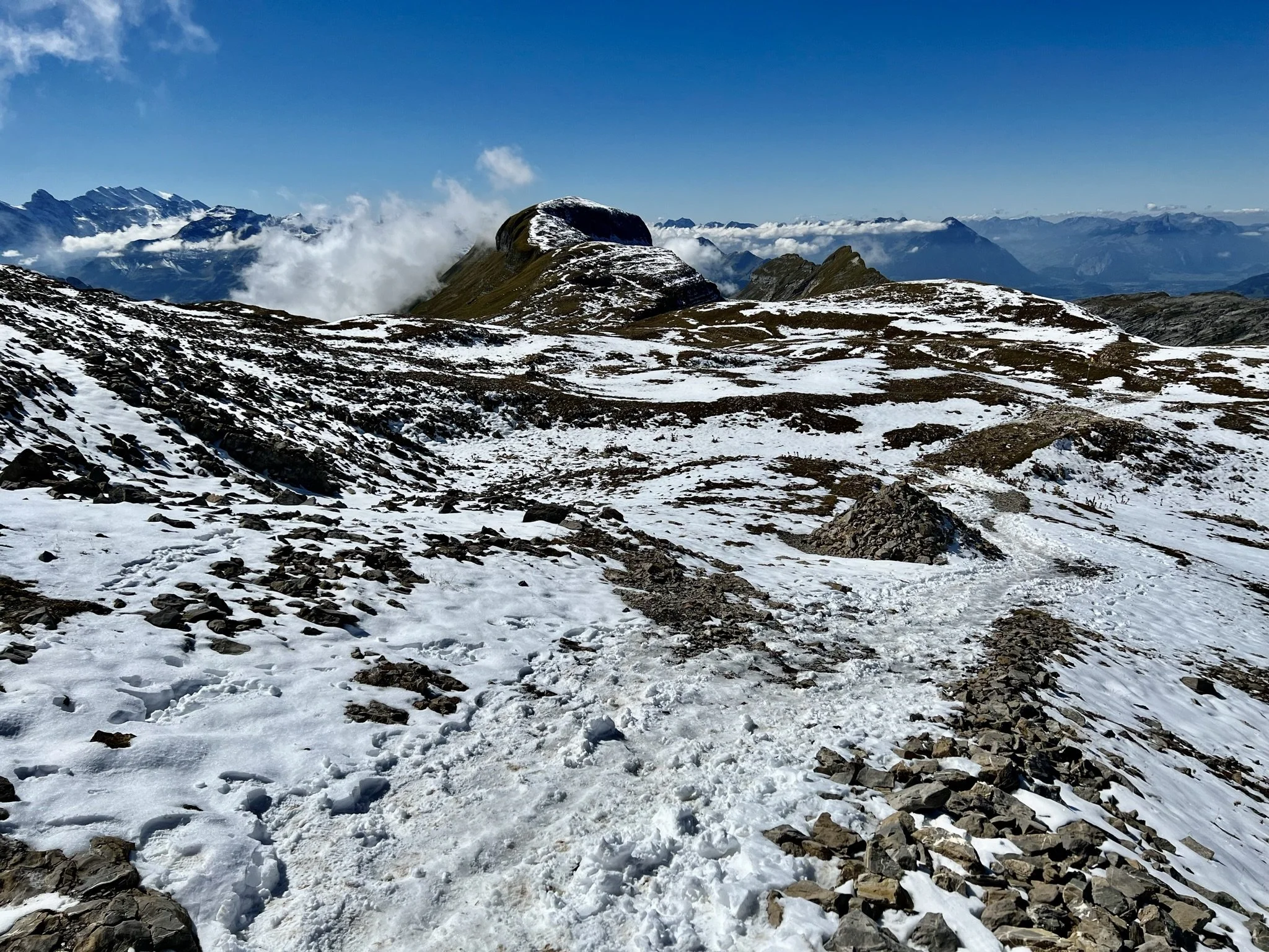
Looking east on the way up to the Berghaus Männdlenen. The summit of the Faulhorn is visible in the far distance.
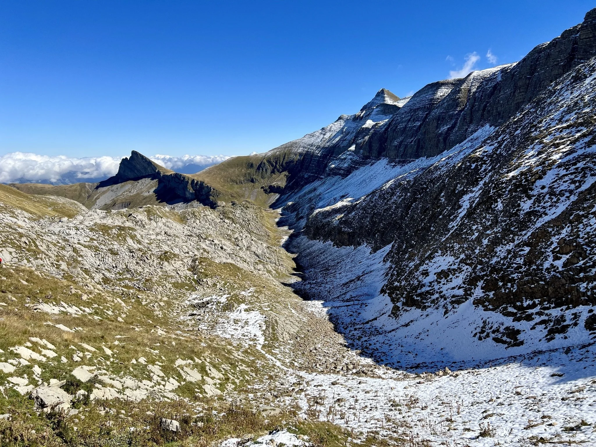
I had thought that the sharp turn to Berghaus Männdlenen might bring some south-facing respite from the snowfall, but alas not. Immediately past the hut I encountered what (given the conditions) I considered the most challenging part of the walk - a stepped path that would have again presented no difficulties but for the ice. Eventually the ice started to become more intermittent, but with the altitude increasing as the shadow of the ridgeline decreased, it still created some tricky patches to navigate along the way.
There is some debate about the best way to complete this hike. At 2,165m, the top of the gondola lift at First is almost a full 200m higher than the station at Schynige Platte - so by heading west to east, I was adding some significant extra climbing onto an already strenuous hike. I had however opted for the slower, more gradual ascent. I could also give myself a head start, as the first train from Wilderswil to Schynige Platte departs much earlier than the first ascent of the cableway in Grindelwald. Most importantly for today, I was ascending through the icy sections, which was definitely the better direction to travel. Descending through the snow really did not look like much fun.
In the snow on the Faulhornweg
A final view of Sägistalsee with Brienzersee and the Hardergrat in the background, and the snow in the foreground
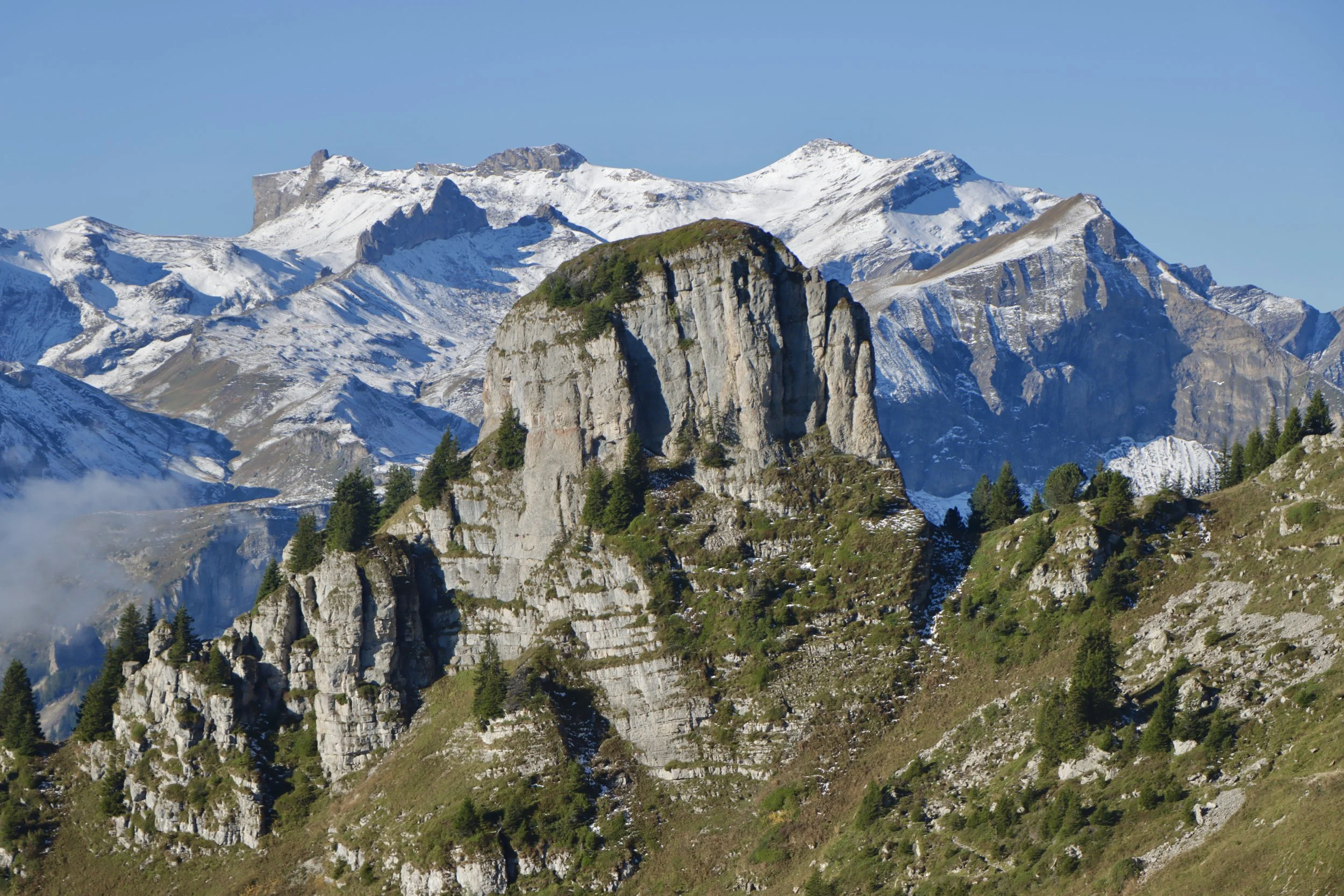
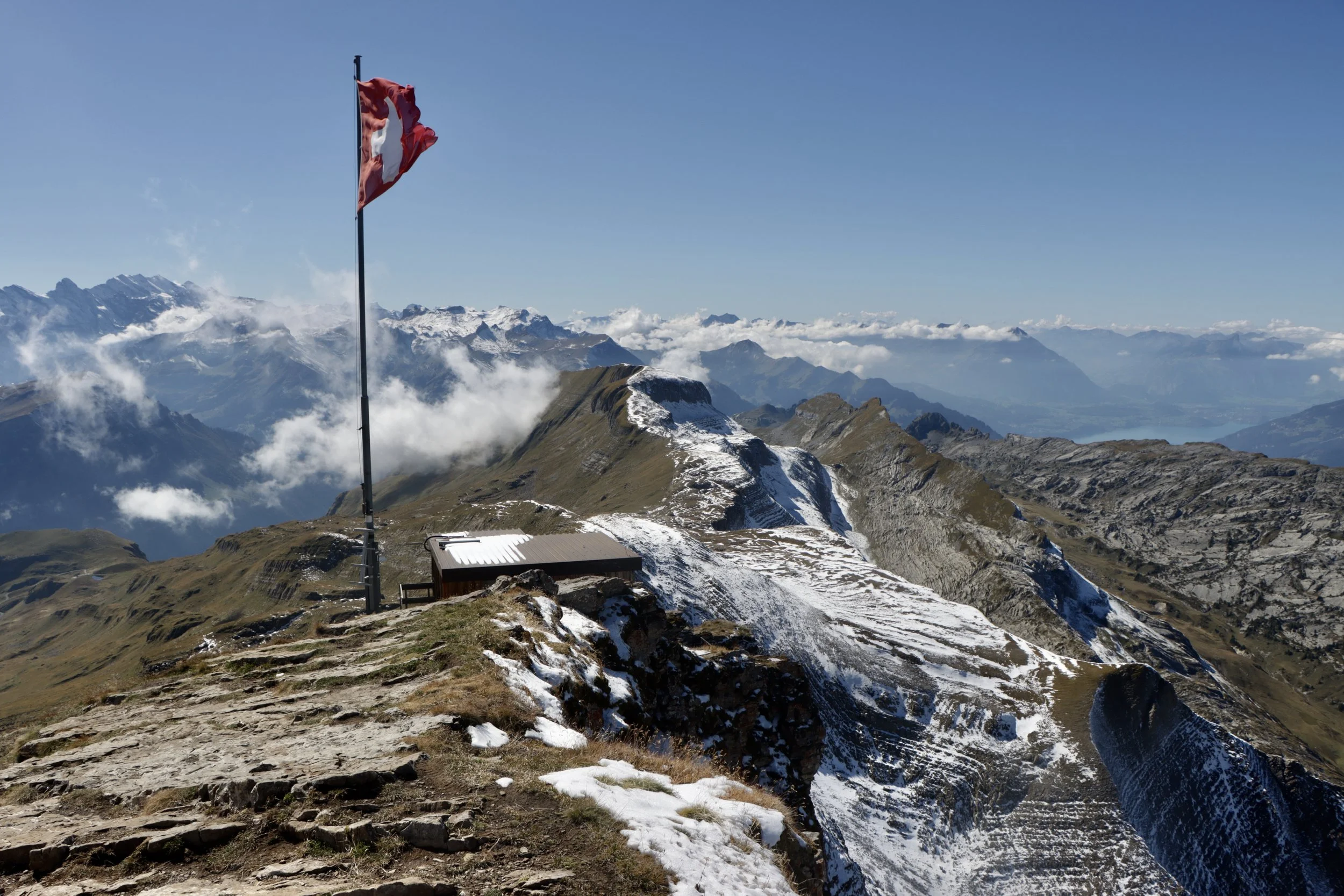
By this point in the walk, you can clearly see the famous hotel on the Faulhorn ahead of you - the high point of the walk. This remarkable structure is almost 200 years old, having been built back in 1830. It houses a mountain hostel and a restaurant, although in the end I did no more than dip my head inside the door for a quick nosy.
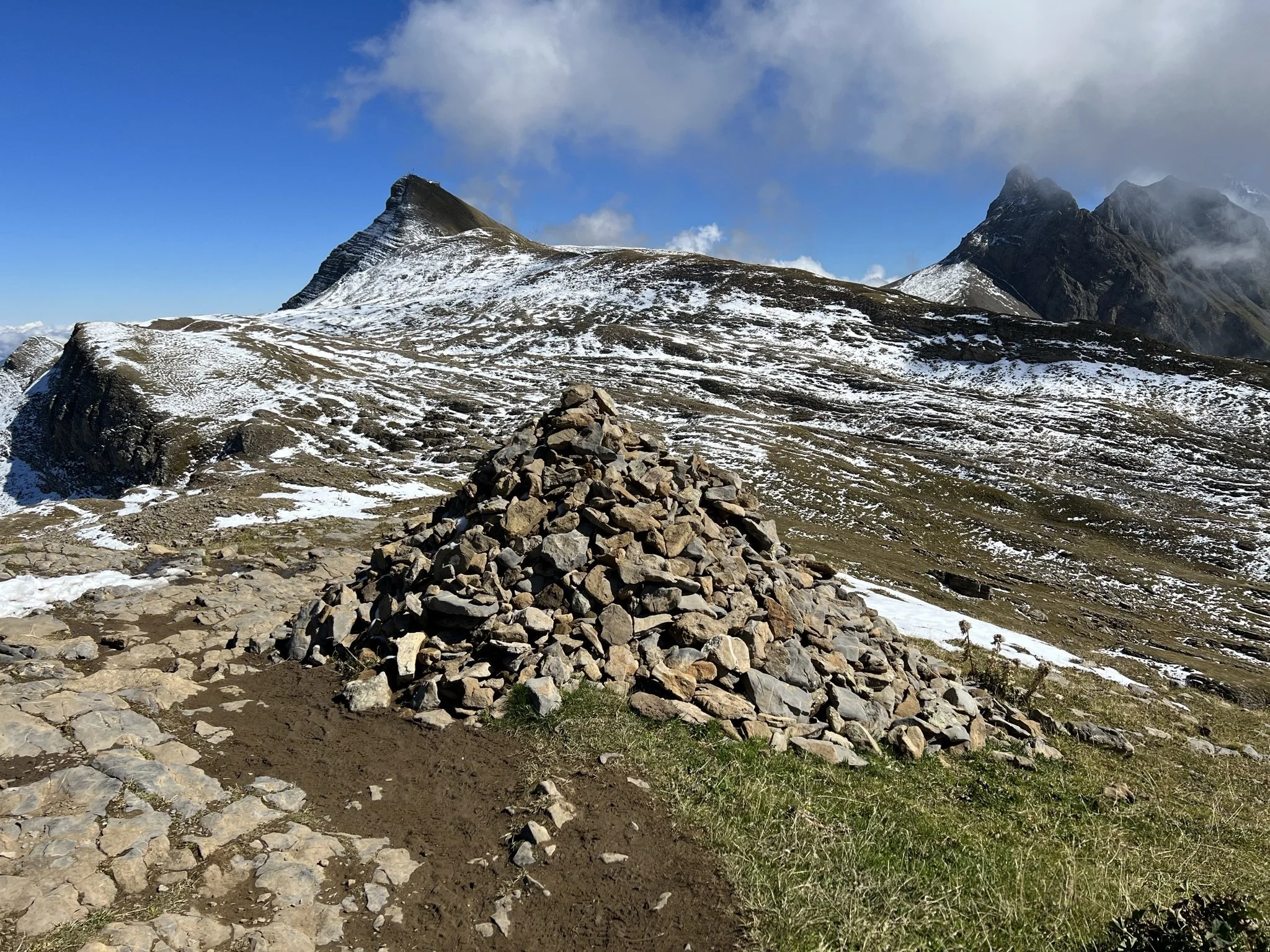
The trail ahead, with the Faulhorn in the distance
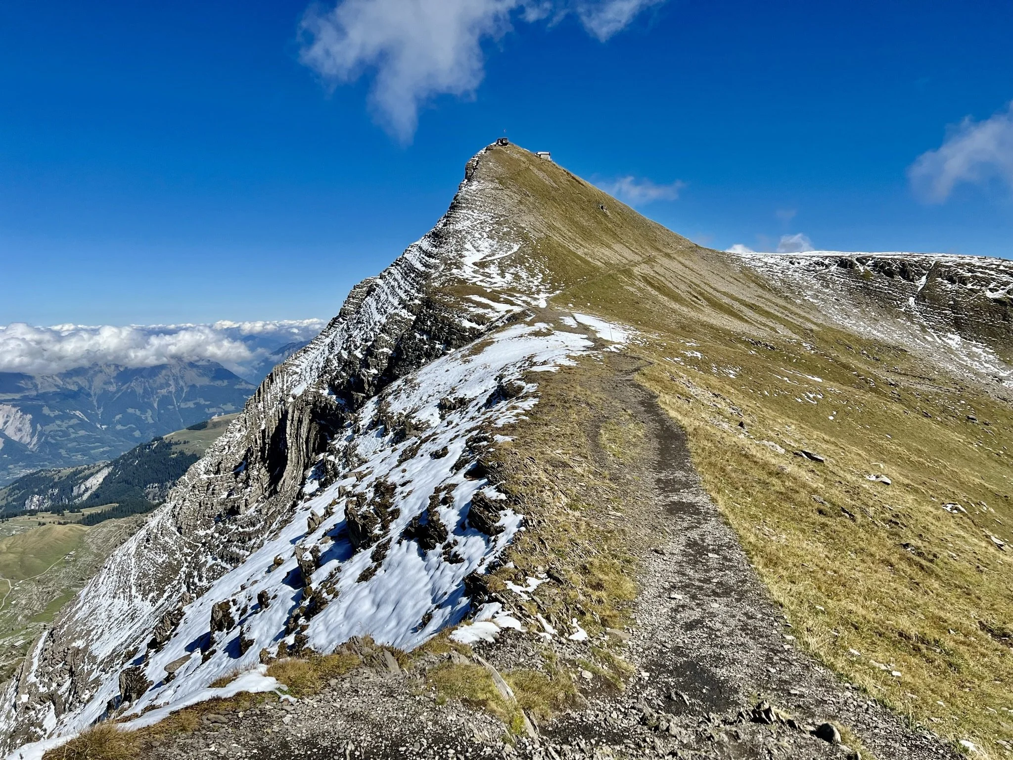
Final approach to the Faulhorn
Upon reaching 2,567m, the trail forks, with the direct route hugging the ridge line up to the summit. However, with some lingering ice clearly visible, I took the right-hand path instead, contouring south of the peak to meet the sturdier (and south-facing!) main zig-zag path that leads to the berghotel.
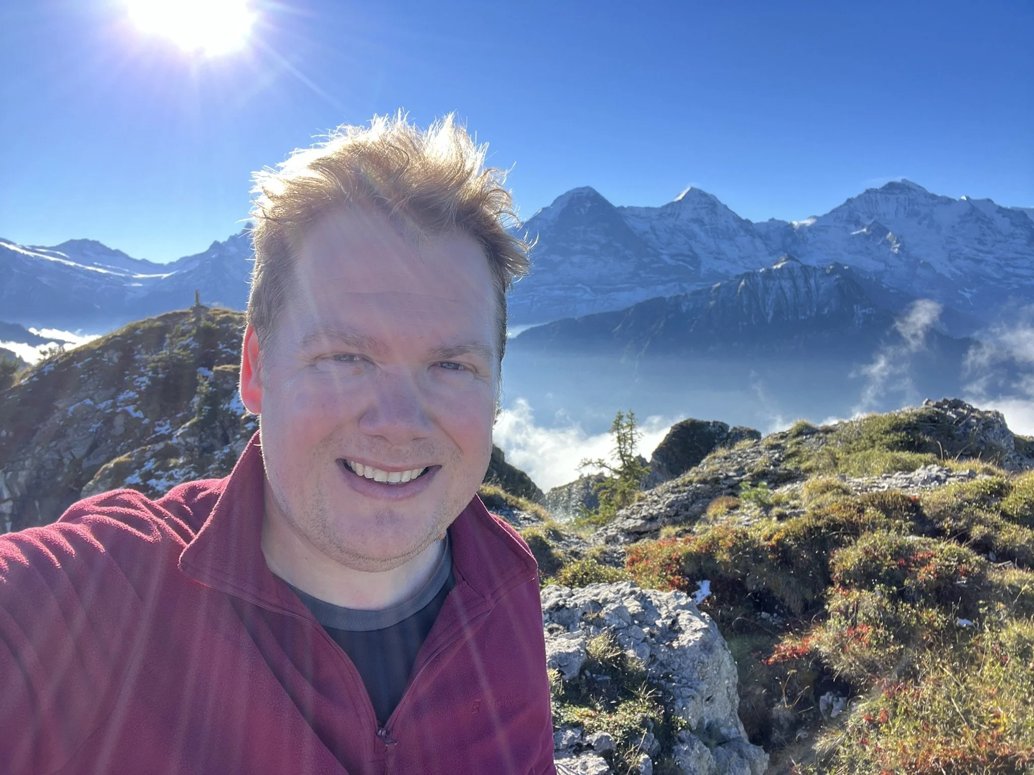
At 2,681m above sea level, the Faulhorn summit was not only the high point of my hike but also the highest point I have ever reached under my own steam (I'm not sure climbing the staircase from the cable car to the Klein Matterhorn viewing platform at 3,883m really counts, and sitting in an aeroplane seat definitely doesn't). There's always a bit of a rush at the summit of a climb, but this was definitely a new level of achievement for me. There's a remarkable view from the summit, made all the more rewarding by the genuine challenge of getting there. Whilst I never quite felt out of my comfort zone, the snow and ice created a level of physical and mental challenge that I hadn't experienced before - especially as a solo hiker.
I made it!
Looking west from the Faulhorn summit. If you look closely at the centre-right, you can see the trail up to the Berghaus Männdlenen
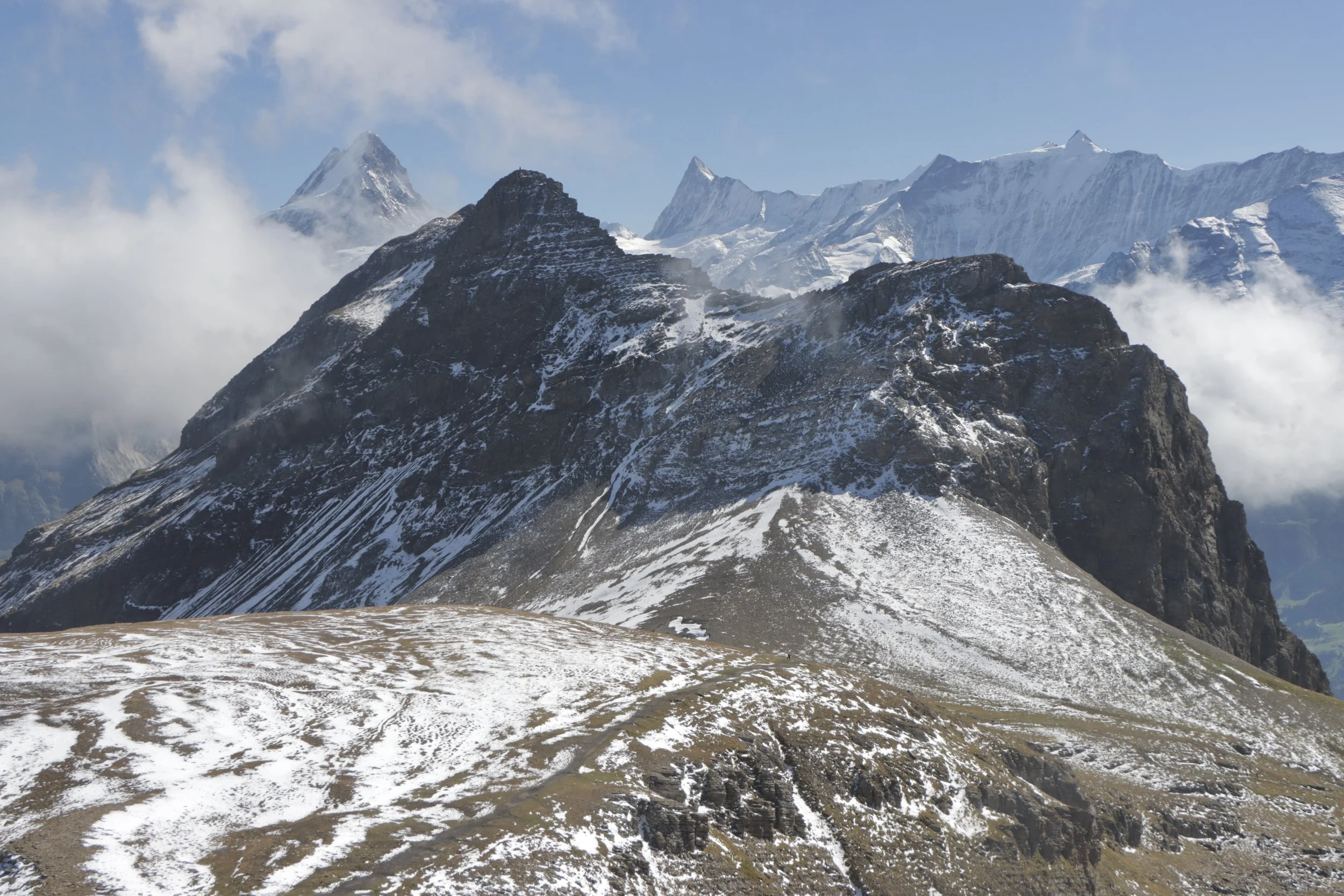
Looking east from the Faulhorn summit towards the Schwarzhorn
The brooding peak of Reeti, looking south from the upper slopes of the Faulhorn
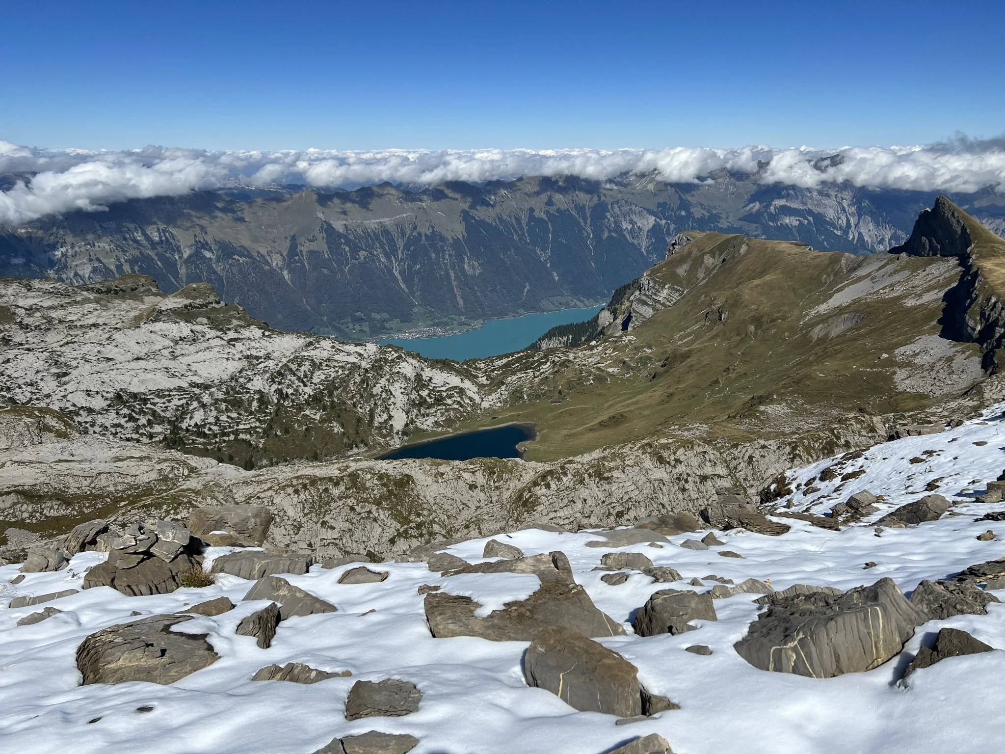
Looking north from the Faulhorn down to Brienzersee, with the Sägistal reappearing in the centre-left of shot.
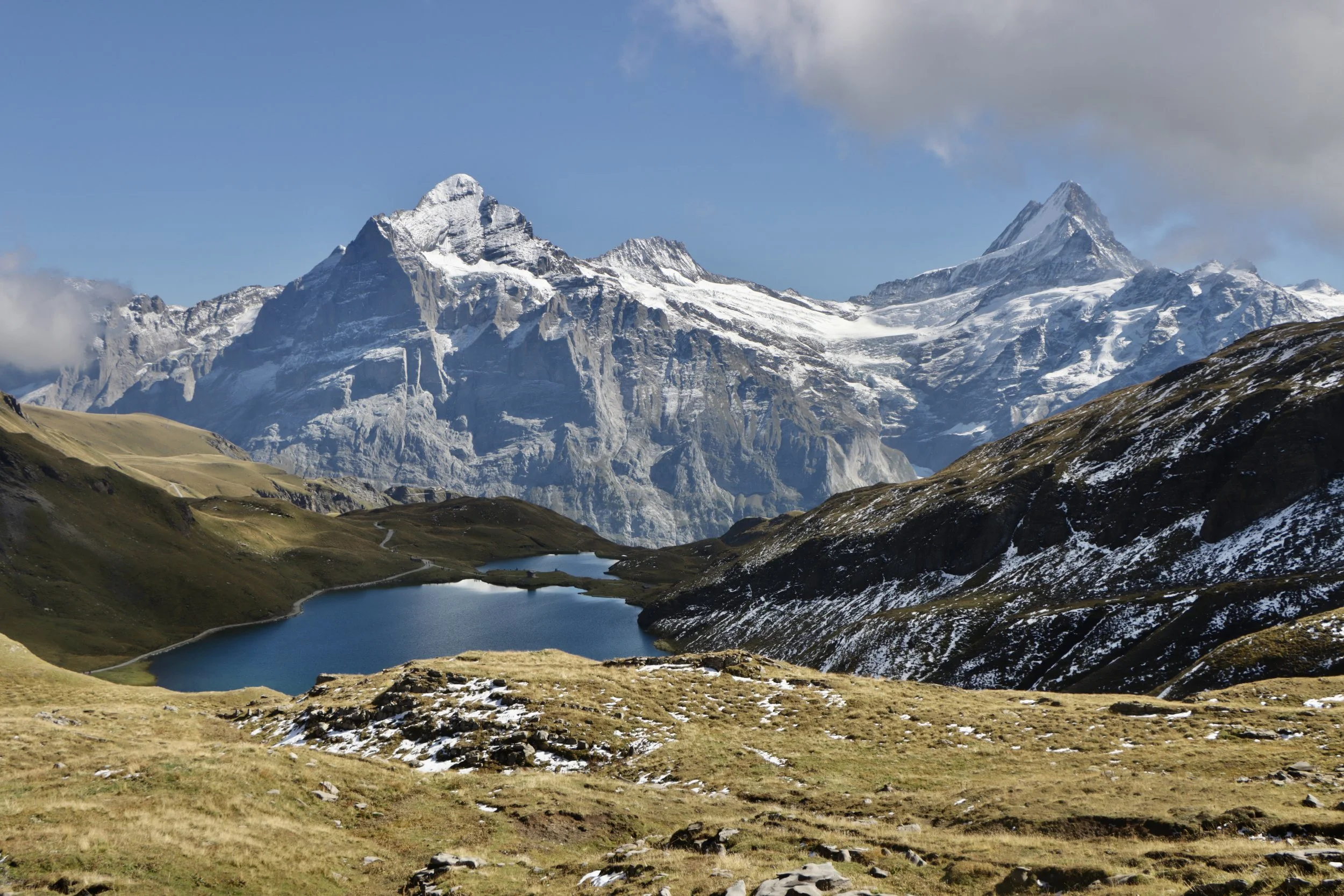
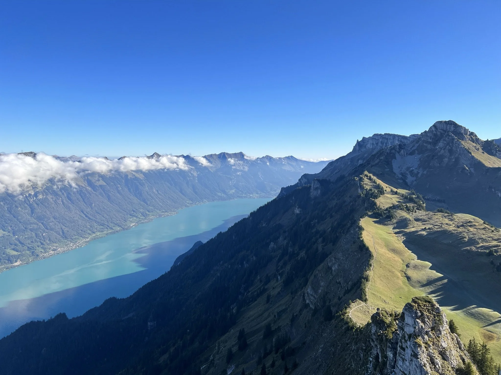
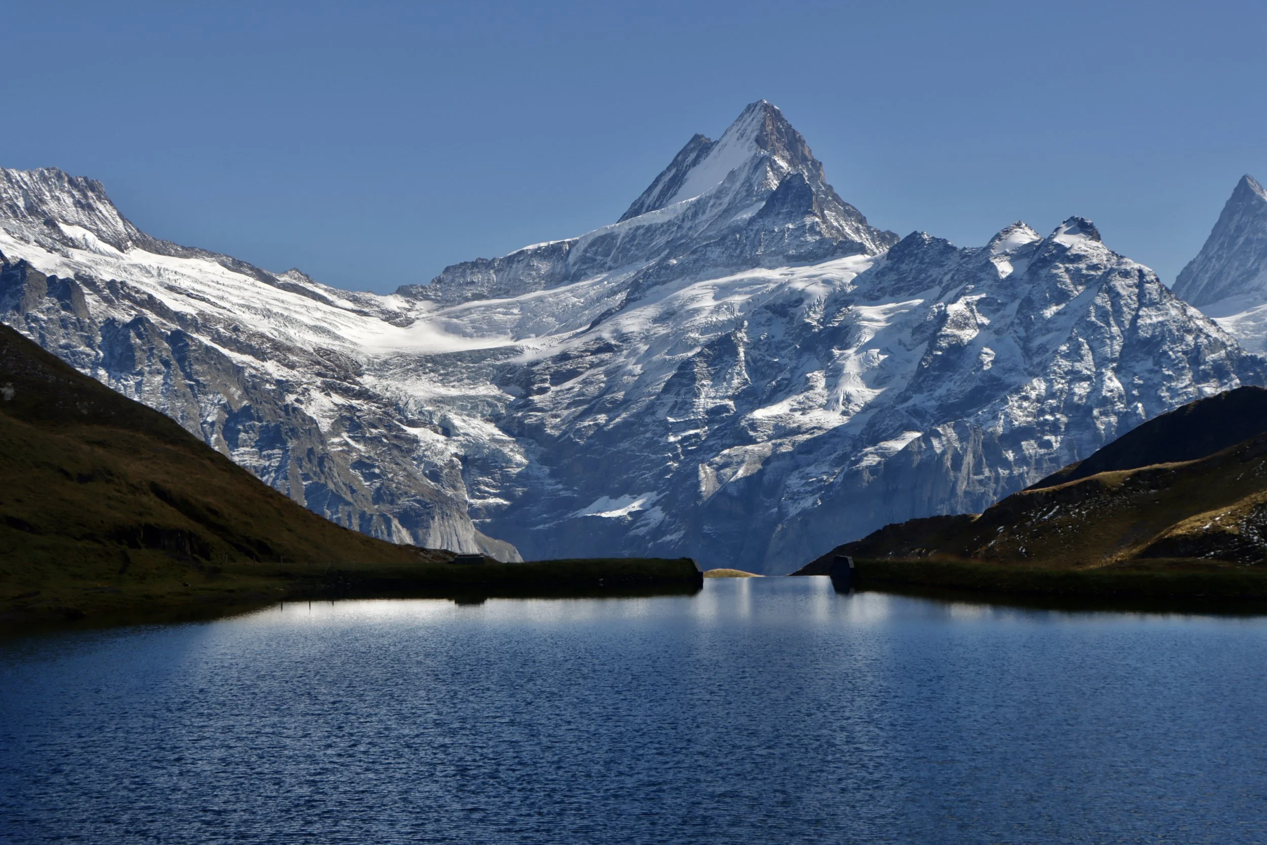
Although the descent to the gondola station at First is notably steeper than the ascent from Schynige Platte, it's also on a well-maintained path throughout so it presents no technical challenge. There was a smattering of snowfall on the higher slopes, but by this stage it had become purely pretty rather than risk-inducing. It doesn't take long for the final gem of the walk to reveal itself - the breathtaking Bachalpsee with the Schreckhorn and Wetterhorn as the backdrop. I'd seen Bachalpsee before, but never from above, and it still exceeded my expectations. One of the best mountain views in the world.
Bachalpsee with the Wetterhorn (left) and Schreckhorn (right) for company
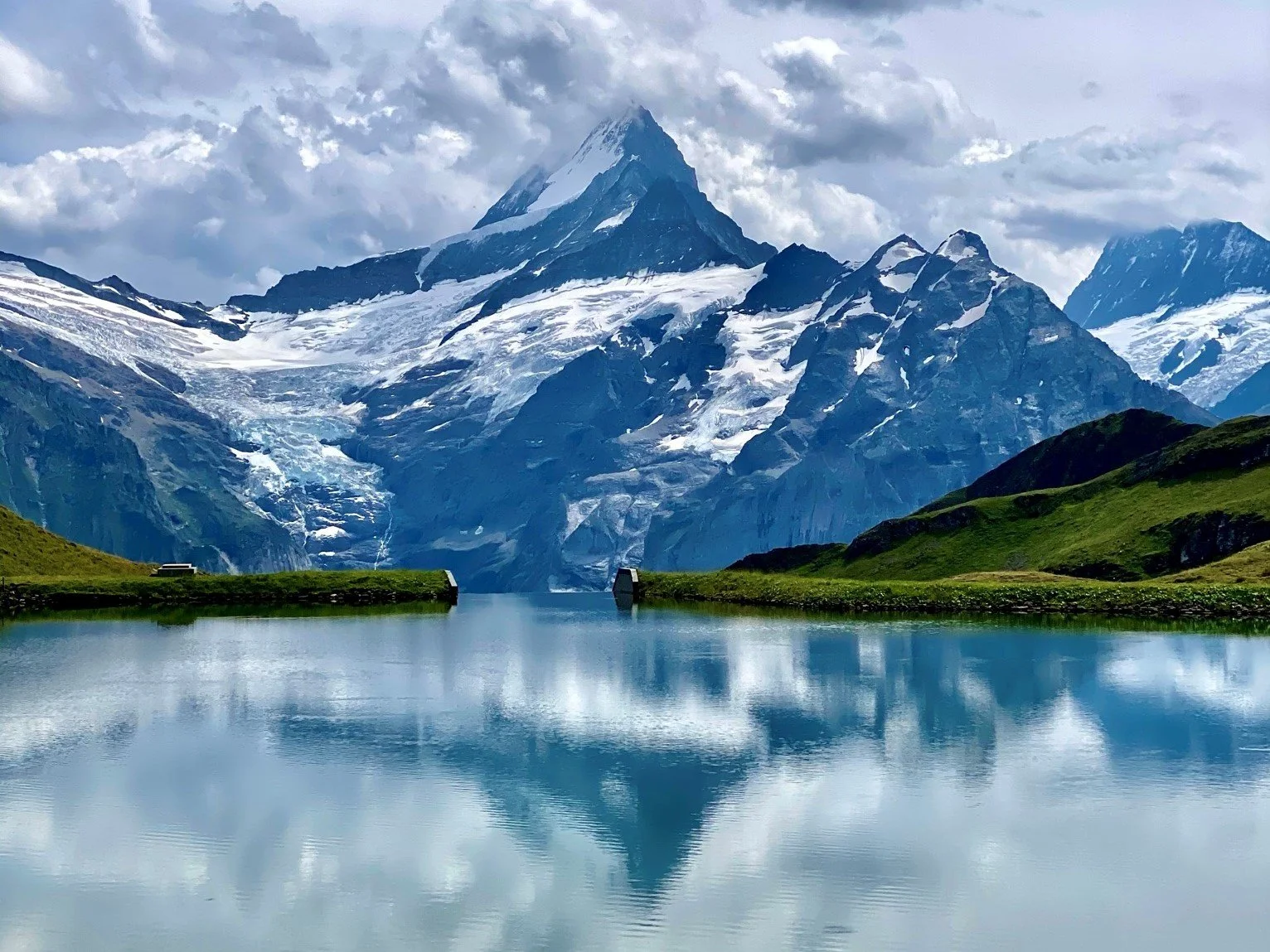
The walk from First to Bachalpsee is a relatively gentle ascent by alpine standards, so reaching the lakeshore means rejoining the tourist trail and the accompanying crowds. The view of the Schreckhorn reflected in the waters of Bachalpsee is so postcard perfect I don't even mind using the cliche. On my 2022 visit, there was no reflection in the lake, but it still looked beyond beautiful. As a reward for persevering so far into this article, I'm only too pleased to share a 2020 photograph, complete with the majestic reflecting Schreckhorn.
Bachalpsee and Shreckhorn, September 2022
Bachalpsee and Schreckhorn, August 2020
From Bachalpsee, the herds of tourists are even easier to spot than the herds of cows in the meadows. The path is clear, wide, gentle, and well-signposted back to First for the gondola lift down to Grindelwald. The views do not relent; as you descend, help yourself to the view down into the valley as well as across to Kleine Scheidegg and the north face of the Eiger - an adventure for another day. If you've not exhausted your supply of adrenaline, the berghaus at First has a plethora of options before you descent, including a constructed cliff walk and viewpoint (free) and a range of (definitely not free) thrill rides including zip-wires, trotti bikes, and mountain carts. If you have, sit back and enjoy the gondola ride back down into the town.
Eiger and Kleine Scheidegg from First (taken August 2020)
So is this the “best day hike in Switzerland”? It certainly has to be a contender, but I think I might have to head back and try a few more alpine hikes to come to a definitive opinion. It was an exhilarating experience for me, and with the snowfall it was undoubtedly the most mentally challenging hike I’ve ever completed. Absent the ice, it would no doubt be equally compelling but with no technical difficulties. I’d love to do it again.
A final note: please don’t use this article as a route guide. I’d love to find out that I had inspired one or two people to visit, but my words are no substitute for a proper trail guide and a map. This is a challenging high mountain hike that requires a good level of fitness, planning, and mountain nous. Make sure you are properly prepared for any mountain walk. Happy hiking!
Thanks so much for reading! If you liked this article, you might also like: